
Pest Free Onetahua
Over the last few months, we have been assisting Pest Free Onetahua with data collection, analysis and visualisation.
The predator eradication programme, funded by Predator Free 2050, covers an area stretching from Onetahua Farewell Spit south to the Whanganui Inlet, taking in the Kaihoka Scenic Reserve and Pakawau Forest and, with the support of landowners, some private land bordering these areas. Home to thousands of birds, Onetahua is a wetland of international significance. A critical stopover for migrating wader birds, it gained international status as a Ramsar site in 1976. Onetahua is also home to other native species. Powelliphanta and other carnivorous snails, geckos, skinks, carabid beetles and weta are also at risk of predation. Vegetation on the Spit is susceptible to grazing by possums who have been causing damage to the Rata in Pakawau Forest.
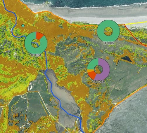
Mohua Maps has set up mobile apps for collecting predator monitoring data, which live-feeds into dynamic data dashboards and web maps back at the office. We’ve analysed vegetation heights to assist with navigation and planning and created static maps of the area and monitoring device locations which are being used in meeting with external and internal stakeholders. This is all helping to build a picture of the current predator population and distribution, which will inform decisions about trapping strategies in the future. It great to be a part in protecting and restoring such an iconic and important landscape.
Find out more about the programme here: https://onetahuarestoration.org.nz/