
Natural environment mapping and GIS is our specialty
Services
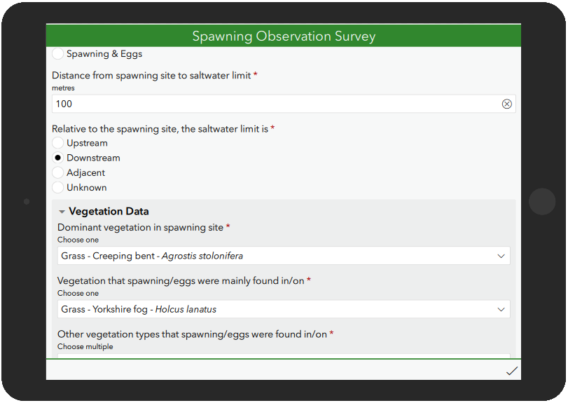

Field Data Collection
We develop field data collection solutions for mobile devices that enhance efficiency and data quality compared to traditional paper methods. Our solutions allow for instant calculations of complex data, saving you valuable time when you return to the office. With extensive fieldwork experience, we understand what works best in real-world conditions, ensuring our tools are practical and effective for your needs.
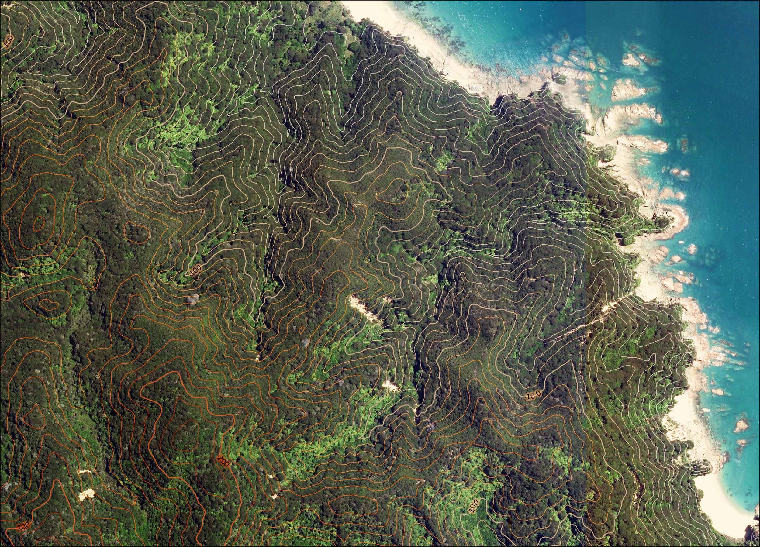
Spatial Analysis
Have a question or problem involving spatial data? With years of experience analyzing natural environment data like LiDAR (elevation), vegetation data, and aerial imagery, we can help. Our expertise is applicable to a wide range of projects, from individual properties to large-scale catchment and landscape analyses.
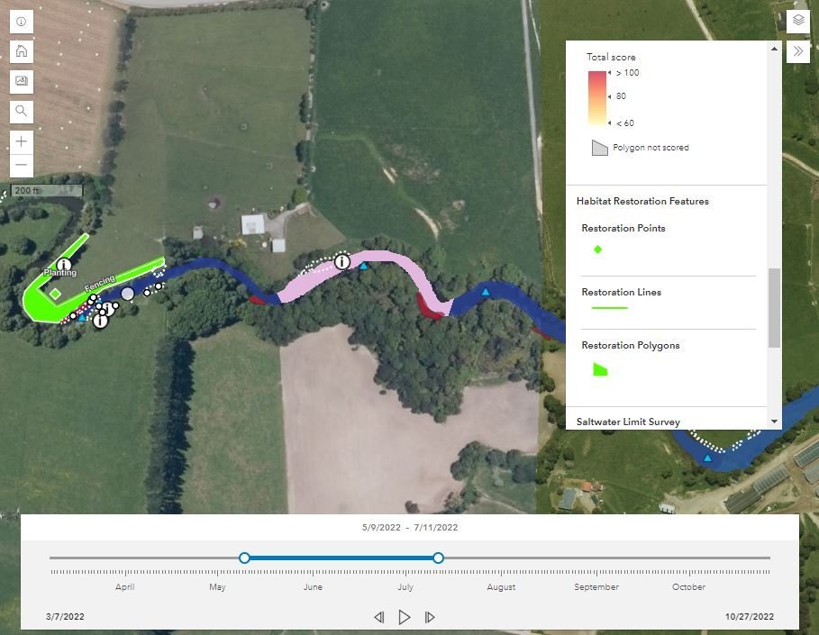

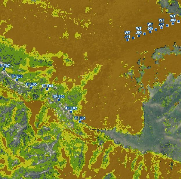
Data Visualisation
We excel in presenting your data through dynamic and visually engaging methods. Whether it's current data or information collected in the field, we can showcase it in live-updated online maps and interactive dashboards. These tools enhance viewer engagement and improve understanding by making the data more accessible and interactive.


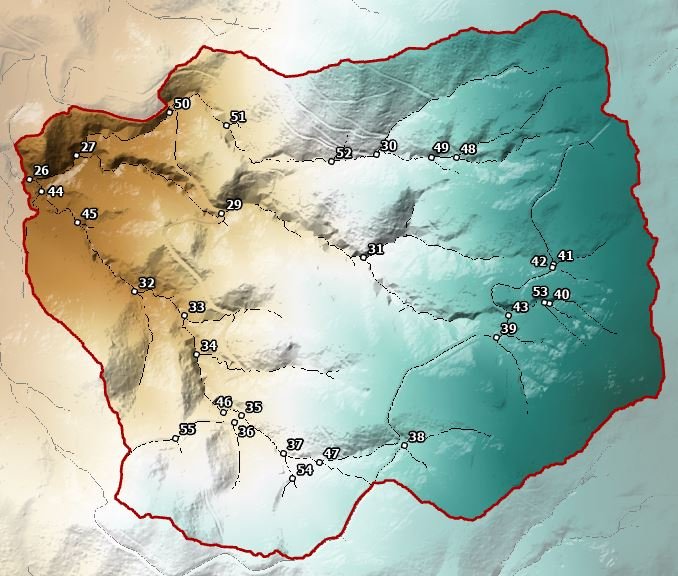
Static Maps
We design accurate, clear, and visually engaging maps tailored to your specifications. Whether you need maps for print, digital reports, or your website, we ensure they meet your needs and effectively communicate your data.

Ecology and Conservation Field Work
We bring hands-on expertise in ecological census techniques, invasive weed and pest control, wilding pine management, habitat assessment, tree and vegetation surveying, and more. This extensive field experience enriches our GIS work, ensuring that the tools and data we provide are practical and intuitive for your field teams. Our aim is to create a easy to access link between fieldwork and GIS applications, enhancing efficiency and data quality in the field. Additionally, we’re available to conduct fieldwork directly, should you need on-the-ground support.